Snow and high winds forecast as Storm Diego hits France
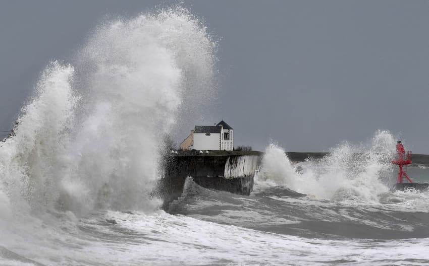
High winds, heavy rain and snow in some areas are forecast for Friday as Storm Diego hits France.
High winds are forecast to begin on Thursday, with Météo France placing the north of France, plus the island of Corsica, on a yellow warning for high winds.
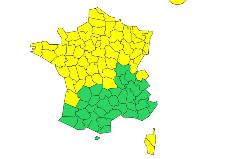
Map: Meteo France
Winds of up to 80km/h are forecast on Thursday, with the weather turning more severe on Friday when Storm Diego is forecast to hit northern and central France.
Séquence agitée ces deux prochains jours avec #pluies copieuses sur les 2/3 nord et vents forts. On suivra tout particulièrement vendredi la dépression #Diego : #vents tempétueux, pluies soutenues, #neige en plaine et cumuls en montagne.
Restez informés https://t.co/g1014gURMb pic.twitter.com/Yufu8b1yjZ
— VigiMétéoFrance (@VigiMeteoFrance) April 6, 2022
"On Friday, an active disturbance will cross the northern half of the country and will produce stormy winds. It will be accompanied by sustained rainfall from Brittany to the Vosges, adding to the heavy rainfall of the previous day," warned Météo France.
Winds will rise to around 100 km/h an hour, with the worst affected areas central and south-west France.
In higher areas, the rain may fall as snow - "a brief episode of snow on the plain, from Haute-Normandie to the Ardennes is expected" added Météo France.
Comments
See Also
High winds are forecast to begin on Thursday, with Météo France placing the north of France, plus the island of Corsica, on a yellow warning for high winds.
Winds of up to 80km/h are forecast on Thursday, with the weather turning more severe on Friday when Storm Diego is forecast to hit northern and central France.
Séquence agitée ces deux prochains jours avec #pluies copieuses sur les 2/3 nord et vents forts. On suivra tout particulièrement vendredi la dépression #Diego : #vents tempétueux, pluies soutenues, #neige en plaine et cumuls en montagne.
— VigiMétéoFrance (@VigiMeteoFrance) April 6, 2022
Restez informés https://t.co/g1014gURMb pic.twitter.com/Yufu8b1yjZ
"On Friday, an active disturbance will cross the northern half of the country and will produce stormy winds. It will be accompanied by sustained rainfall from Brittany to the Vosges, adding to the heavy rainfall of the previous day," warned Météo France.
Winds will rise to around 100 km/h an hour, with the worst affected areas central and south-west France.
In higher areas, the rain may fall as snow - "a brief episode of snow on the plain, from Haute-Normandie to the Ardennes is expected" added Météo France.
Join the conversation in our comments section below. Share your own views and experience and if you have a question or suggestion for our journalists then email us at [email protected].
Please keep comments civil, constructive and on topic – and make sure to read our terms of use before getting involved.
Please log in here to leave a comment.