'Atmospheric river' prompts flood and avalanche alerts in southwest France
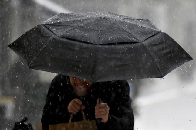
An ‘atmospheric river’ is bringing concerted, heavy rain to southwest France, prompting warnings of flooding and avalanches in seven Pyrenean départements.
National forecaster Météo-France has placed seven departments traversing the length of the Pyrénées mountain chain on orange alerts - its second-highest weather alert, which warns anyone in the area to be ‘very vigilant’.
The Pyrénées-Atlantiques and Hautes-Pyrénées are on orange alert for the risk of rain and flooding. The Gers, Landes and Pyrénées-Atlantiques are on orange alert for flooding. Finally, Hautes-Pyrénées, Haute-Garonne, Ariège and the Pyrénées-Orientales face an unusually high risk of avalanches for the season.
The unusually wet weather is being driven by a weather phenomenon known as an "atmospheric river" - a narrow corridor of concentrated moisture in the atmosphere - while a large sea swell along the Basque coast will block the flow of rivers into the Atlantic, which could lead to flooding upstream.
En bout de course d'une rivière atmosphérique et dans un vigoureux courant de nord-ouest, les Pyrénées Atlantiques et les Hautes-Pyrénées seront soumises dans les prochaines 48 h à des pluies abondantes. 60/80 mm sur le piémont, 80/120 mm sur le relief d'ici vendredi 12 h. (1/2) pic.twitter.com/vkCLZtjJST
— VigiMétéoFrance (@VigiMeteoFrance) December 9, 2021
Atmospheric rivers are described by scientists as "long, meandering plumes of water vapour often originating over the tropical oceans that bring sustained, heavy precipitation to the west coasts of North America and northern Europe".
It has the potential to cause long periods of sustained rainfall in winter months. The particular "river" causing heavy rain in southwest France is "at the end of its course" Météo-France said, but will still lead to very high precipitation in the coming hours.
Between 50 and 70mm are expected by the middle of Friday in the Basque Country, and 80 to 100mm in the relief of the Pyrenees. But the level of rain and a rise in temperatures in the Pyrénées have also prompted an avalanche warning following several days of major snowfalls.
READ ALSO Winter weather: Pyrenees and French Alps set for more snow
Météo-France said: “avalanche activity expected from Thursday afternoon to Friday morning is observed on average once every two years, but is atypical this early in the winter season”.
“These avalanches will be able to affect roads … and mountain infrastructure,” the forecaster warned in its latest bulletins.
With the intensification of the rains, these avalanches will be able to carry away all the snow cover already in place. The peak of avalanche activity will coincide with the intensification of the rains and should begin in the middle of the afternoon for the massifs close to the Atlantic, in the late afternoon for the central Pyrenees and in the early evening for the Pyrénées-Orientales.
Comments
See Also
National forecaster Météo-France has placed seven departments traversing the length of the Pyrénées mountain chain on orange alerts - its second-highest weather alert, which warns anyone in the area to be ‘very vigilant’.
The Pyrénées-Atlantiques and Hautes-Pyrénées are on orange alert for the risk of rain and flooding. The Gers, Landes and Pyrénées-Atlantiques are on orange alert for flooding. Finally, Hautes-Pyrénées, Haute-Garonne, Ariège and the Pyrénées-Orientales face an unusually high risk of avalanches for the season.
The unusually wet weather is being driven by a weather phenomenon known as an "atmospheric river" - a narrow corridor of concentrated moisture in the atmosphere - while a large sea swell along the Basque coast will block the flow of rivers into the Atlantic, which could lead to flooding upstream.
En bout de course d'une rivière atmosphérique et dans un vigoureux courant de nord-ouest, les Pyrénées Atlantiques et les Hautes-Pyrénées seront soumises dans les prochaines 48 h à des pluies abondantes. 60/80 mm sur le piémont, 80/120 mm sur le relief d'ici vendredi 12 h. (1/2) pic.twitter.com/vkCLZtjJST
— VigiMétéoFrance (@VigiMeteoFrance) December 9, 2021
Atmospheric rivers are described by scientists as "long, meandering plumes of water vapour often originating over the tropical oceans that bring sustained, heavy precipitation to the west coasts of North America and northern Europe".
It has the potential to cause long periods of sustained rainfall in winter months. The particular "river" causing heavy rain in southwest France is "at the end of its course" Météo-France said, but will still lead to very high precipitation in the coming hours.
Between 50 and 70mm are expected by the middle of Friday in the Basque Country, and 80 to 100mm in the relief of the Pyrenees. But the level of rain and a rise in temperatures in the Pyrénées have also prompted an avalanche warning following several days of major snowfalls.
READ ALSO Winter weather: Pyrenees and French Alps set for more snow
Météo-France said: “avalanche activity expected from Thursday afternoon to Friday morning is observed on average once every two years, but is atypical this early in the winter season”.
“These avalanches will be able to affect roads … and mountain infrastructure,” the forecaster warned in its latest bulletins.
With the intensification of the rains, these avalanches will be able to carry away all the snow cover already in place. The peak of avalanche activity will coincide with the intensification of the rains and should begin in the middle of the afternoon for the massifs close to the Atlantic, in the late afternoon for the central Pyrenees and in the early evening for the Pyrénées-Orientales.
Join the conversation in our comments section below. Share your own views and experience and if you have a question or suggestion for our journalists then email us at [email protected].
Please keep comments civil, constructive and on topic – and make sure to read our terms of use before getting involved.
Please log in here to leave a comment.