Weather forecasters predict white Christmas for these areas of France
Those hoping for a white Christmas could be in for a last-minute pleasant surprise, as the French national weather agency Météo France predicts colder temperatures from Wednesday and snowfall in several parts of the country over the holidays.
This November was the second warmest ever registered in Europe, according to the European weather service Copernicus, and December so far in France has so far been mostly mild and wet.
?November #temperature highlights from #Copernicus #C3S:
?️ Globally, last month was the warmest November on record, by a clear margin
?️ For Europe, the month roughly tied as the second warmest on record
More➡️https://t.co/Y8oyVV6JKG pic.twitter.com/YZRvakGlaE
— Copernicus ECMWF (@CopernicusECMWF) December 7, 2020
But on Thursday, December 24th, "the snow is making a comeback," according to Météo France, although the first round of snowfall will be over mountainous such as the Alps, Jura, Pyrenees and Vosges.
❄️ Point enneigement || Inexistant à basse & moy. altitude, modeste ➕ haut, rien d'anormal au début de la saison. Chutes de neige jusqu’à basse altitude prévues à partir du 24/12, l’enneigement devrait vite reprendre des couleurs pratiquement partout.
?https://t.co/HCbeMQNtfM pic.twitter.com/8806sN15Nt
— Météo-France (@meteofrance) December 23, 2020
In the coming days, temperatures across France will plunge. Starting from the north west and spreading towards the south east, the entire country will lose between 3C and 6C on December 24th, according to Météio France.
The biggest drop will be in the south west, where the weather agency said some areas will lose between 8C and 10C overnight.
On Saturday the south of France will get colder too.
Who gets snow for Christmas?
Météo France has predicted snowfalls over the the east of France on December 24th and 25th, notably in the regions Grand Est, Bourgogne-Franche-Comté and Auvergne-Rhône-Alpes.
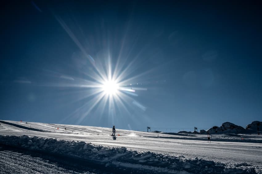
However mountainous areas will get the heaviest snowfall, the agency wrote in a separate note. The last week of December will likely be cold and sunny, which means ideal skiing conditions in these areas. While ski resorts have been allowed to reopen, ski lifts remain closed until at least January 7th, depending on the health situation.
How much of France usually gets snow?
It really depends on the year, but over the course of the last decade snow has been largely reserved France's mountainous areas. The interactive map below shows which ares have got at least 5mm of snow from 1979 until 2019.
❄️?Vous souvenez-vous d'un #Noel blanc ?
?Avec @CopernicusEU @ECMWF, plongez dans 40 ans d'archives pour découvrir les régions qui ont été enneigées à Noël.
➕d'infos ?https://t.co/wAIQ5u3cyw pic.twitter.com/nxhBxDKBiW
— Météo-France (@meteofrance) December 21, 2020
Comments
See Also
This November was the second warmest ever registered in Europe, according to the European weather service Copernicus, and December so far in France has so far been mostly mild and wet.
?November #temperature highlights from #Copernicus #C3S:
— Copernicus ECMWF (@CopernicusECMWF) December 7, 2020
?️ Globally, last month was the warmest November on record, by a clear margin
?️ For Europe, the month roughly tied as the second warmest on record
More➡️https://t.co/Y8oyVV6JKG pic.twitter.com/YZRvakGlaE
But on Thursday, December 24th, "the snow is making a comeback," according to Météo France, although the first round of snowfall will be over mountainous such as the Alps, Jura, Pyrenees and Vosges.
❄️ Point enneigement || Inexistant à basse & moy. altitude, modeste ➕ haut, rien d'anormal au début de la saison. Chutes de neige jusqu’à basse altitude prévues à partir du 24/12, l’enneigement devrait vite reprendre des couleurs pratiquement partout.
— Météo-France (@meteofrance) December 23, 2020
?https://t.co/HCbeMQNtfM pic.twitter.com/8806sN15Nt
❄️?Vous souvenez-vous d'un #Noel blanc ?
— Météo-France (@meteofrance) December 21, 2020
?Avec @CopernicusEU @ECMWF, plongez dans 40 ans d'archives pour découvrir les régions qui ont été enneigées à Noël.
➕d'infos ?https://t.co/wAIQ5u3cyw pic.twitter.com/nxhBxDKBiW
Join the conversation in our comments section below. Share your own views and experience and if you have a question or suggestion for our journalists then email us at [email protected].
Please keep comments civil, constructive and on topic – and make sure to read our terms of use before getting involved.
Please log in here to leave a comment.