Snow, high wind and heavy rain: France braced for winter weather front
Snow is forecast across France on Tuesday as a winter depression named Gabriel sweeps in from the Atlantic, bringing strong winds and heavy rain which will turn to snow as it moves north.Paris could turn white once again.
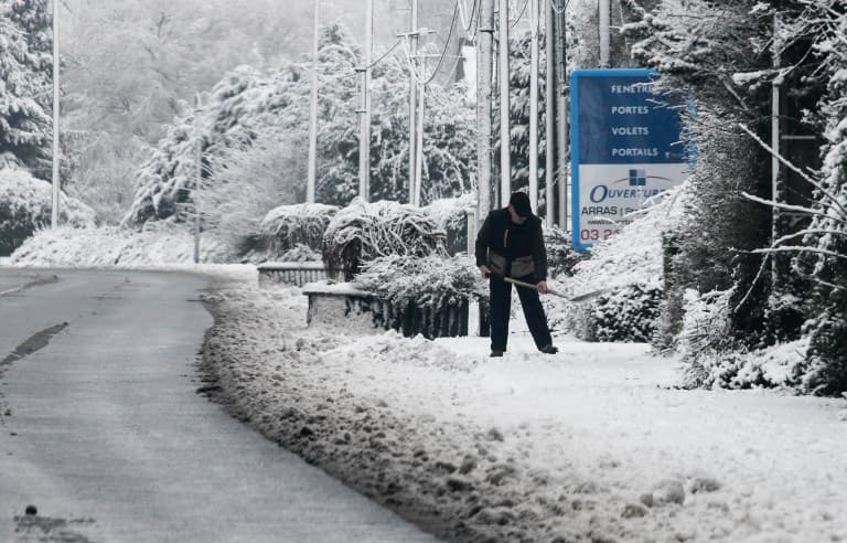
It's time to get out the warm winter clothes again as snow is forecast across many parts of France Tuesday and Wednesday, with some high winds expected on the Atlantic coast.
On Tuesday a winter depression called 'Gabriel' with heavy rain or snow on higher ground and strong winds is set to blow in from the Atlantic.
It will meet with a cold front as it moves North, bringing snow to many parts of France, according to the French weather forecaster Météo France.
Prévision || La dépression Gabriel devrait aborder le pays par l'ouest ce mardi après-midi. Conséquences : vents soutenus sur le littoral atlantique,
110 à 130 km/h en soirée et chutes de neige dans la nuit de mardi à mer. notamment du Centre-Val de Loire au sud Île-de-France. pic.twitter.com/7RhIgj5lKo
— Météo-France (@meteofrance) January 28, 2019
Between 5 to 15cm of snow could fall on parts of the country as a result, with strong winds creating snowdrifts in some areas.
Drivers have been warned to prepare for difficult driving conditions in many regions on Tuesday night because of the snow.
Où va-t-il neiger cette semaine? https://t.co/6pPp9J38k2
— BFMTV (@BFMTV) January 28, 2019
Flakes will start to fall mid-afternoon in Normandy around parts of Paris and in Britanny.
On Tuesday evening, strong winds of up to 130 km/h will blow on the coast in the south-west of France.
⚠️La dépression #Gabriel apportera des rafales à caractère tempétueux sur la façade atlantique à partir de demain après-midi ! Dans les terres, Gabriel apportera un fort coup de vent. ? pic.twitter.com/h9AJllGgn0
— La Chaîne Météo (@lachainemeteo) January 28, 2019
In the North, snow is forecast in the Île-de-France with over 10cm expected around the Paris region.
The departments of the Centre-Val-de-Loire and Hauts-de-France departments should also see snow.
Further south, the Auvergne Rhône-Alpes region and the departments of Vienne, Creuse, Haute-Vienne, Lozère, Hérault, Gard, Vaucluse and most of the Bouches-du-Rhône will also be affected.
In the South West, heavy snow has has been falling in the Pyrenees since Sunday.
With more snow expected, parts of the Pyrenees have been placed under an orange weather warning because of the risk of avalanches.
These are Pyrénées-Atlantiques, Hautes-Pyrénées, the Ariège and the Haute-Garonne.
Un véritable #blizzard s'abat depuis hier soir sur les #Pyrénées. 30 à 50cm de neige sont tombés à 900 mètres d'altitude à #Gèdre (65). L'accès aux stations de ski est parfois impossible.
Source : https://t.co/3VzcQh2Rl2 pic.twitter.com/zFF9b8BqRE
— La Chaîne Météo (@lachainemeteo) January 28, 2019
Comments
See Also
Prévision || La dépression Gabriel devrait aborder le pays par l'ouest ce mardi après-midi. Conséquences : vents soutenus sur le littoral atlantique,
— Météo-France (@meteofrance) January 28, 2019
110 à 130 km/h en soirée et chutes de neige dans la nuit de mardi à mer. notamment du Centre-Val de Loire au sud Île-de-France. pic.twitter.com/7RhIgj5lKo
Où va-t-il neiger cette semaine? https://t.co/6pPp9J38k2
— BFMTV (@BFMTV) January 28, 2019
⚠️La dépression #Gabriel apportera des rafales à caractère tempétueux sur la façade atlantique à partir de demain après-midi ! Dans les terres, Gabriel apportera un fort coup de vent. ? pic.twitter.com/h9AJllGgn0
— La Chaîne Météo (@lachainemeteo) January 28, 2019
Un véritable #blizzard s'abat depuis hier soir sur les #Pyrénées. 30 à 50cm de neige sont tombés à 900 mètres d'altitude à #Gèdre (65). L'accès aux stations de ski est parfois impossible.
— La Chaîne Météo (@lachainemeteo) January 28, 2019
Source : https://t.co/3VzcQh2Rl2 pic.twitter.com/zFF9b8BqRE
Join the conversation in our comments section below. Share your own views and experience and if you have a question or suggestion for our journalists then email us at [email protected].
Please keep comments civil, constructive and on topic – and make sure to read our terms of use before getting involved.
Please log in here to leave a comment.